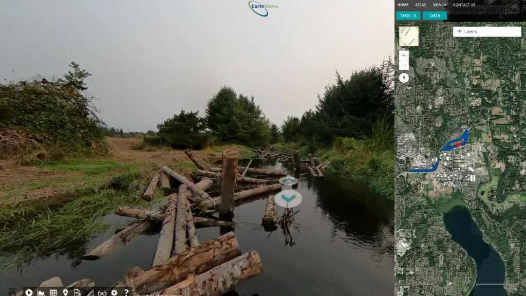
How would a 360 degree virtual image map benefit your restoration project or conservation efforts?
How it Works
Our Commitment
We want every organization to see the benefits of a historical record of the waterway, trail, restoration project or natural area they care about.
Apply
Tell us about your project, its impact on the habitat and community, and how a 360 degree virtual map will be used.

Map
The prize winner will map their project. Don’t have a camera? No worries, you can borrow one of ours.

Share
Your 360 degree virtual map will be available for all to see on earthviews.com. Use it for outreach, education, impact measurement, or fund raising.
Example Entries
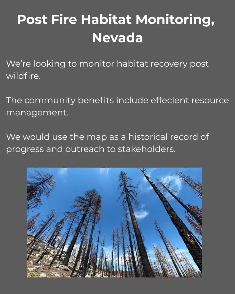
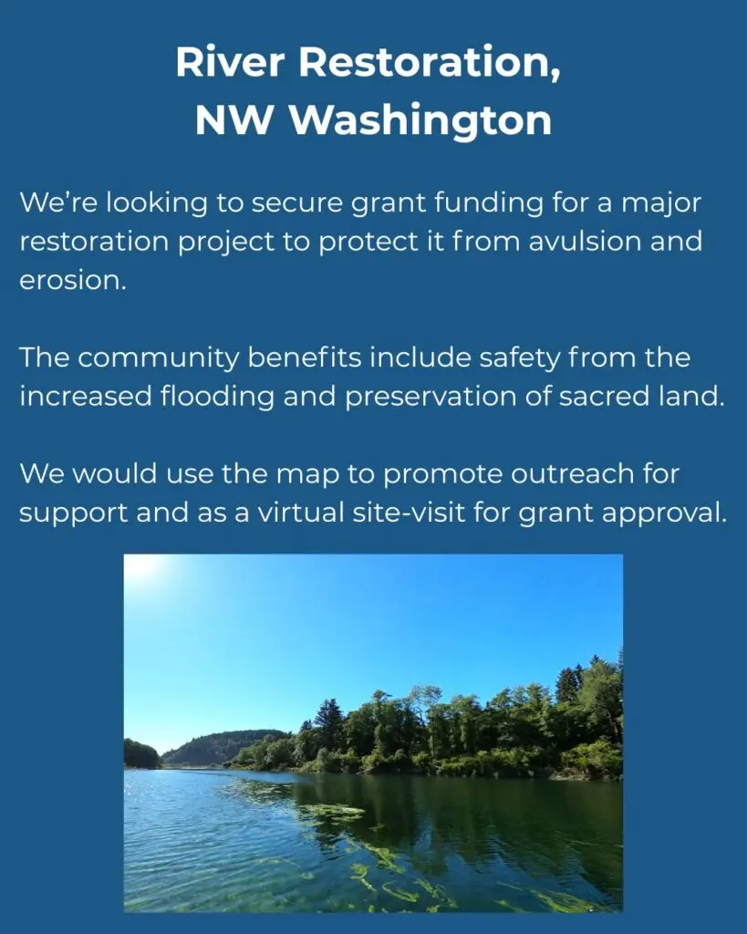
Here are a couple examples of how project descriptions might be worded.
FAQ
Do I need to be part of a non-profit to enter?
Nope. Any organization or individual involved in conservation or restoration may enter. Kayakers, Hikers, Engineering Firms, Friends of Awesome River!
Do I have to collect the images?
Yes. You do the leg work (or paddle work), we’ll do the computer work.
Do I need to have my own camera?
Nope! It certainly makes things easier, but if you need to check out one of our loaner kits, we got you!
How does the judging work?
When you submit your entry form, we’ll screen for alignment with our mission and hand it over to our panel of judges. Judging will be based impact, feasibility, and alignment with EarthViews services.
How do I know if I've won?
We’ll contact you via the information you provide on the entry form. We’ll also announce the winner on our website on October 9th, 2026.
Where can I ask questions or learn more?
You can email contest@earthviews.com with any questions.
Wait! What's EarthViews, again?
EarthViews makes maps – 360-degree virtual maps (kinda like Streetview, but created and controlled by you and for you). Check out our website www.earthviews.com or our fun little “about us” video.
When??
Entry deadline: October 5th
Winner announced: October 9th
Rules:
UGH! I know, we hate rules, too. But here they are anyway:
EarthViews “River and Trail Map” Contest – Official Rules
Sponsored by: EarthViews
Deadline to Apply: October 5, 2026
Winners Announced: October 9, 2026
Purpose
The goal of this contest is to support river/trail conservation and restoration efforts by offering professional services through EarthViews. We’re seeking compelling projects that will benefit from public visibility and digital engagement.
Prize
$2500 EarthView: A virtual, interactive map of your project, as collected by you. We will provide up to $2500 of services to process, publish, and host your map.
Eligibility
Open to organizations, private firms, or individuals engaged in river, stream, trail, or natural area conservation or restoration.
Applicant must be authorized to represent the project and organization.
How to Enter
1. Submit the official entry form.
The entry form will ask for your project description, contact info, and an image/drawing/map of your location.
Judging Criteria
A panel of EarthViews staff and conservation partners will judge entries based on:
-Environmental or recreational impact
-Feasibility and alignment with EarthViews services
Fine Print
Winners will be contacted via email and announced on EarthViews website. This contest is not affiliated with LinkedIn.
Projects must be initiated within 6 months of award.
EarthViews reserves the right to feature winners’ stories, images, and project outcomes.
No purchase necessary. Void where prohibited.
Complete Terms and Conditions are available here.