
Engineering Solutions
Contact UsCustomized “Streetview” of your project
Esri integration brings additional GIS power to EarthViews’ already robust toolset.
Use EarthViews technology to enhance communication with team members or clients, reduce extra field visits and create a comprehensive “before and after” picture of your work.
EarthViews is your easy button for 360° content. Our collection kit is completely agnostic and can be attached to nearly any vehicle – boat or kayak, car or gator, even a kite or backpack.
After a quick set-up, the camera simply runs while you complete your scheduled walk-through or survey. Now you have a digital twin of pre-work conditions to return to virtually from your desktop any time.
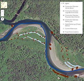
Engineering use cases include comprehensive visual records of dock and bank conditions pre-dredging, virtual walkthroughs of stormwater infrastructure to preserve and assess current conditions, wetland delineation, and to assess the success of engineered log jams for salmon habitat restoration.
ArcGIS Overlays
Add an Esri ArcGIS Feature Layer to the basemap
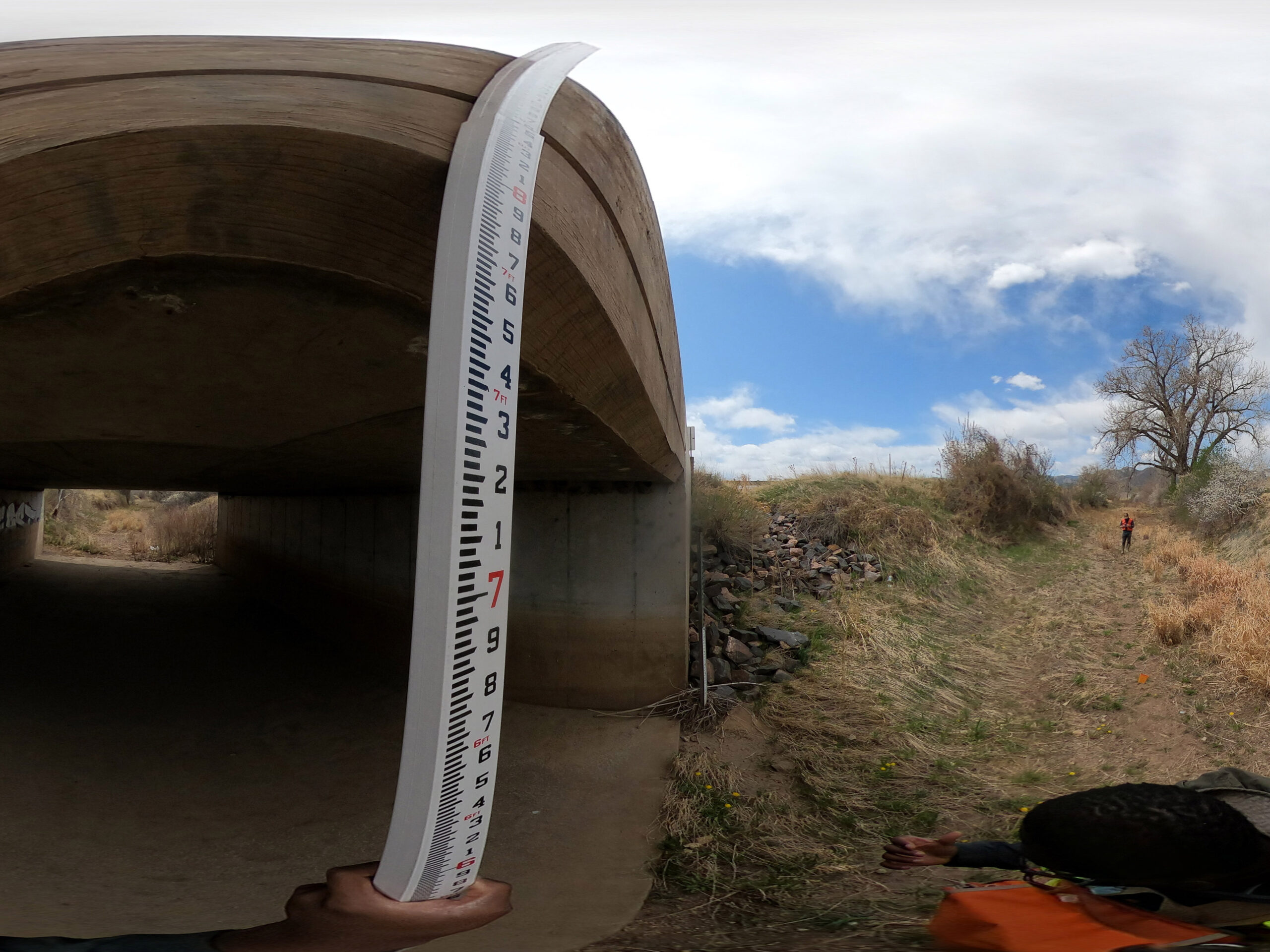
Stormwater Infrastructure
Enginuity Engineering deployed EarthViews technology for their survey and assessment of Denver Area stormwater infrastructure. Their client is able to virtually walk through the entire system.
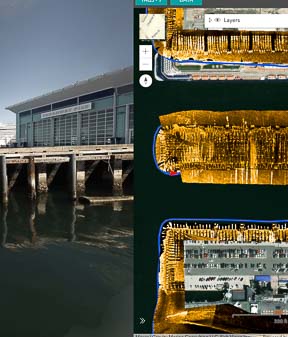
Side-scan Sonar Overlay
Through Esri’s ArcGIS Online, we can overlay a survey partner’s sonar shape-file.
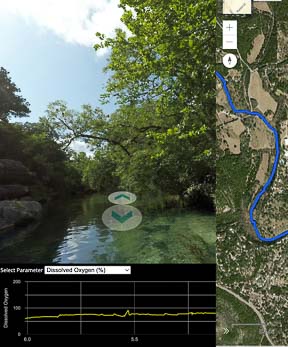
Linear Data Display
EarthViews’ graph function displays Water Quality or other data collected along the length of the survey. Easily jump to inflection points to visually assess a potential cause.
Featured Project
Visionary Environment Engineering firm, Enginuity, adds EarthViews 360 to survey reports in order for their clients to virtually walk the entire stormwater infrastructure system from their desktop 24/7.
where would you like to go next?
Contact us to create your next map.